Wondering what your 5, 10, or 40 acres near Harrison might sell for? You are not alone. Pricing rural land feels tricky because every parcel is different. The good news is you can use a simple, local framework to get a confident range before you list or make an offer. In this guide, you will learn what drives per-acre value around Harrison, what to verify, and how to turn parcel features into a realistic price range. Let’s dive in.
What drives value around Harrison
Acreage values in the Harrison area depend on a handful of core factors. Focus on these first:
- Access and road type. Paved public roads usually earn the strongest pricing, followed by public gravel. Private easements or long drives often sell at a discount based on condition and legal clarity.
- Utilities at the road. Electric at the road is a big deal. Natural gas is uncommon, so propane is typical. Public water or sewer is rare outside villages and would be a premium.
- Usable buildable acres. Buyers care about where a house, septic, and driveway can go. Wetlands, flood zones, steep slopes, or poor soils reduce usable acreage and value.
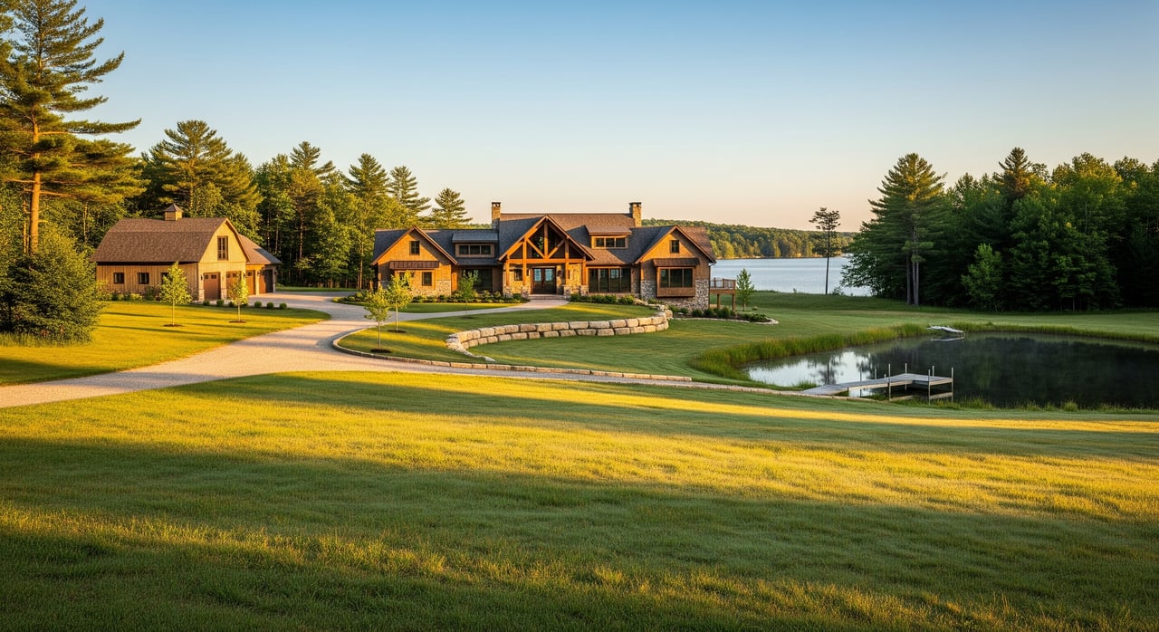
- Water features. Streams and ponds add recreation appeal. Lake frontage or deeded access can command large premiums, often priced by frontage as much as by acres.
- Timber and habitat. Mature hardwoods or pine may add value and privacy, especially on larger tracts, though timber is usually a modest part of total value.
- Split potential and zoning. If a parcel can be divided into multiple saleable lots, value per acre can jump because each buildable lot carries retail demand.
- Size, shape, and frontage. Smaller buildable parcels (1–10 acres) often bring higher per-acre pricing than very large tracts. Long, narrow shapes and limited frontage can reduce value.
- Market conditions. Recent sales, seasonality, and inventory matter. Values move with rates, demand for second homes, and recreational interest.
- Title and easements. Clear, recorded access is valuable. Restrictions or disputes can cause discounts.
- Taxes and ownership costs. Property taxes, special assessments, and shared road costs impact a buyer’s math.
Start with local comps
Begin by finding a recent per-acre baseline for similar land in Clare County or within about 5–15 miles. Focus on size, access, utilities, and water features. If close comps are thin, pick a reasonable regional baseline and treat it as a working figure while you gather more data.
Count usable acres, not just gross
Gross acres are a starting point. The key is usable/buildable acres. Identify the likely home site, septic area, and driveway route. If wetlands, floodplain, steep slopes, or poor soils are present, usable acreage can be much lower than gross, which reduces value.
- If a parcel is 20 acres but only 12–14 acres are realistically buildable, base most of your pricing on the buildable portion rather than the full 20.
- When a parcel has meaningful wetlands, treat wetland acres at a lower per-acre rate instead of pricing them the same as uplands.
Access and utilities adjustments
Access and utilities are among the first value drivers buyers ask about. As a starting point, these directional ranges can help you adjust your baseline:
- Public paved road: roughly +10% to +35% vs. gravel or private.
- Public gravel road: baseline.
- Private easement or long driveway: roughly -10% to -40% depending on condition and legal clarity.
- Electric at the road: roughly +5% to +20%.
- Public water/sewer at the road: roughly +25% to +75% if present, which is rare outside villages.
- Limited broadband or poor cell coverage: roughly -5% to -20% for year-round buyers.
Water, wetlands, and floodplain
Water features and regulated areas can push values up or down.
- Streams and ponds: often add recreational and aesthetic appeal. River frontage tends to be valued less per foot than lake frontage but is still a positive.
- Lake frontage or deeded access: can drive large premiums, sometimes priced by frontage rather than acres. The impact depends on lake size, water quality, and access.
- Wetlands and floodplain: reduce buildable acres and can require permits. Wetland acres often trade at a significant discount, roughly 40% to 90% below upland per-acre value, depending on buildability and use.
Timber and site qualities
Timber adds privacy, habitat, and sometimes harvest value.
- Mature merchantable sawtimber may support a premium of about +5% to +30% based on species and access.
- Young growth or low-value pulpwood is usually neutral to a small premium.
- Gentle, well-drained soils can be baseline to +5% to +15%. Steep or poor soils can present a -10% to -40% impact due to site work costs and septic limits.
Subdivision and zoning potential
Split potential is often the single biggest swing factor. Township zoning, health department septic rules, and frontage requirements set what is possible. If a parcel can be legally divided into multiple saleable lots, total value can increase substantially. A 40-acre tract that can be split into four marketable 10-acre lots may be worth closer to the combined lot values, not a raw acreage rate. The uplift can be 25% to 200% depending on lot demand and infrastructure needs.
Size, shape, and frontage
Shape and frontage affect buildability and marketability.
- Small, buildable tracts in the 1–10 acre range often command higher per-acre pricing.
- Long, narrow parcels or limited road frontage can reduce development options and value, often by about -5% to -25%.
- Lake frontage and substantial road frontage usually support premiums.
Market conditions and timing
Local comps set expectations, but timing matters too. Rural demand can shift with interest rates, employment, and second-home trends. Late spring and summer are often stronger listing seasons, which can help leverage and days on market.
Simple pricing formula
Use this to build a desktop estimate you can refine with comps and quotes:
- Step 1: Set a comparable per-acre baseline (CompRate).
- Step 2: Estimate usable acreage (UsableAc = gross acres × percent usable).
- Step 3: Apply multiplicative adjustments for access, utilities, topography, wetlands, timber, and split potential.
Estimated Value ≈ CompRate × UsableAc × AccessAdj × UtilitiesAdj × TopoAdj × WetlandAdj × TimberAdj × SplitAdj
When wetlands are present, consider pricing wetland acres at a lower rate rather than mixing them into usable acres.
Local price scenarios to expect
These illustrative ranges are common in central Michigan and Clare County. Always verify with current Harrison-area comps.
- Low-value remote wetland or overgrown parcel, limited access, no utilities, non-buildable: roughly 300 to 1,200 dollars per acre.
- Typical rural wooded acreage with gravel road access, electric at the road, acceptable soils, buildable portion 50–80%: roughly 1,200 to 3,500 dollars per acre.
- Strong buildable parcel near paved road with utilities at the road, good soils, partial open fields or a cleared house site: roughly 2,500 to 6,000 dollars per acre.
- Lakefront or high-amenity recreational acreage with deeded frontage or significant water features: roughly 6,000 to 25,000+ dollars per acre, often influenced by frontage-feet and lake quality.
- Large tracts 50+ acres with timber and hunting value but limited frontage: roughly 800 to 3,000 dollars per acre, with larger size often lowering per-acre pricing unless development potential is present.
The low end of these ranges usually indicates serious limitations like non-buildability or poor access. The mid range fits many Harrison-area buildable parcels. The high end is reserved for prime amenities such as lake frontage or strong split potential.
What to verify before pricing
Collect key facts and documents so your price range reflects real conditions on the ground:
- Legal description, parcel number, and current deed. Note easements, mineral reservations, and right-of-way details.
- Parcel map and acreage breakdown. Differentiate gross and usable acres.
- County GIS and assessor record. Check assessed value, recent sales, and tax class.
- Township zoning and land division. Confirm minimum lot size, setbacks, permitted uses, and road frontage rules.
- Septic suitability. Get existing perc or soil boring reports, or budget for testing.
- Utilities at the road. Call providers for distance-to-connect and cost estimates for electric and broadband.
- Road maintenance status. Confirm if the road is county maintained and whether there is a road agreement for private access.
- Floodplain and wetlands. Review maps and consider professional delineation if wetlands appear likely.
- Soils and topography. Use soil survey info to flag septic or drainage limitations.
- Timber and resources. If timber matters, consider a timber cruise and confirm any restrictions.
- Comps. Pull recent similar sales within 6–12 months from local sources.
- Improvement costs. Estimate driveway and culvert, well and septic, grading, and utility extensions.
How to set a price range
Turn your notes into numbers:
- Identify a realistic per-acre baseline from the best local comp set you can find.
- Estimate usable acres and apply the adjustments that clearly fit the parcel.
- Build three scenarios: conservative, mid, and premium. Show what would move the parcel up or down the range.
- Share the assumptions in plain language. Emphasize usable acreage and the effect of splits, utilities, and water features.
This approach helps you stay transparent and credible while you fine-tune with new information.
Common pitfalls to avoid
- Pricing off gross acres when wetlands or poor soils are significant.
- Ignoring legal access clarity. A missing or unrecorded easement can sink value.
- Overlooking broadband and cell service when marketing to year-round buyers or remote workers.
- Assuming split potential without confirming with township and health department rules.
- Skipping comps or using distant markets that do not reflect Harrison-area demand.
Your next steps
If you plan to list soon, pull 3–5 recent comps, verify zoning and split rules, and order a perc test if buildability is uncertain. For parcels with meaningful wetlands, timber value, or subdivision potential, consider a local land appraiser or an experienced land agent early. If you are buying, follow the same checklist and build a realistic improvement budget so you understand your total project cost.
When you are ready for a research-driven pricing conversation and a listing strategy tailored to Harrison and the surrounding Clare County market, reach out to Laura Corpe. Our team pairs local boots-on-the-ground expertise with data-informed campaigns so you can price with confidence and present your acreage at its best.
FAQs
How do I estimate per-acre value for Harrison, MI land?
- Start with recent local comps for similar size and features, estimate usable acres, then apply adjustments for access, utilities, soils, wetlands, timber, and split potential.
What counts as “usable acres” on a rural parcel?
- Usable acres are areas suitable for a home, septic, and driveway; wetlands, floodplain, steep slopes, or poor soils reduce usable acreage and value.
How much does paved road access change pricing?
- Parcels on public paved roads often see a premium of about 10% to 35% over similar land on gravel or private access.
Do utilities at the road increase land value?
- Yes; electric at the road typically supports a 5% to 20% premium, while public water or sewer, if present, can push value higher due to reduced development costs.
How do wetlands affect pricing in Clare County?
- Wetland acres are commonly valued at a large discount, roughly 40% to 90% below upland per-acre value, and they reduce total buildable area.
Why does split potential matter so much near Harrison?
- If a parcel can be legally divided into multiple buildable lots, the total value often rises because each lot can sell at a retail price, increasing the sum beyond raw acreage value.