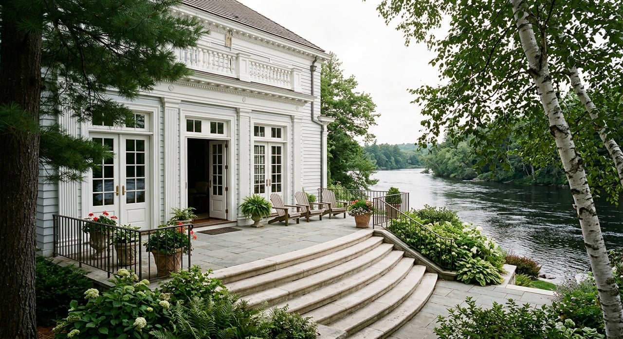
Wondering if Au Sable riverfront near Grayling is the kind of Northern Michigan escape you have been picturing? It can be, but this is one market where two properties on the same river can offer very different day-to-day experiences. If you are thinking about a cabin, year-round home, or vacant parcel along the Au Sable, this guide will help you understand what really matters before you buy. Let’s dive in.
Why Au Sable riverfront stands out
The Au Sable near Grayling has a reputation that reaches far beyond Crawford County. Michigan State University describes it as a Blue Ribbon trout stream, and the Michigan Department of Natural Resources says the river drains 1,932 square miles and runs through parts of Crawford County.
For many buyers, the appeal is easy to understand. You get a mix of trout fishing, paddling, wooded privacy, and a quieter pace that feels like a true Up North retreat. The upper river is groundwater-fed and relatively steady, which helps explain why it is so well known among anglers.
There is also an important ownership detail to understand from the start. The Au Sable is a designated Natural River, which means development near the river is regulated. It also does not mean private riverfront automatically becomes public access, so you should not assume that a public recreation corridor and a private parcel offer the same rights.
What buyers find near Grayling
Riverfront inventory near Grayling is not one-size-fits-all. Recent listing examples in the area show everything from cabin-style getaways and year-round homes to vacant land, larger acreage parcels, and properties with outbuildings or established build sites.
That variety is good news if you are shopping with a specific goal in mind. You may find a simple seasonal place that keeps the focus on the river, or a more practical year-round home with easier access and utility systems built for winter use.
The key is to look beyond the listing description. A property described as a cabin, seasonal retreat, or year-round home may still need closer review of heating, insulation, well and septic condition, and whether the road is maintained and plowed in winter.
Main branch or South Branch?
One of the biggest decisions is not just which property, but which stretch of river. The branch and segment can shape privacy, recreation traffic, and the overall feel of ownership.
Main branch near Grayling
On the main branch east of Grayling, several DNR access points help explain where activity tends to be concentrated. Burton’s Landing is about 3.5 miles east of Grayling, Keystone Landing is about 4 miles east, and the AuSable River State Forest Campground and Canoe Camp is about 7 miles east.
White Pine Canoe Camp is farther downriver at about 15.5 miles east of Grayling. These public access and camping points can make nearby sections more active, especially during paddling and fishing season.
The DNR’s natural river plan notes that canoe use is concentrated in the Grayling to Stephan’s Bridge corridor and on the South Branch, with traffic dropping below takeout points. In simple terms, the closer you are to well-used access sites, the more likely you are to notice weekend paddlers, anglers, and seasonal recreation traffic.
South Branch feel
The South Branch tells a somewhat different story. The DNR says the South Branch natural area is about 15 miles southeast of Grayling and includes about nine miles of undeveloped land bordering the river.
For buyers who want more seclusion, that can be a major draw. Canoe Harbor State Forest Campground is also on the South Branch, about 14 miles southeast of Grayling, and it connects to the Mason Tract Pathway, which includes 8.5 miles of cross-country skiing in winter.
If your idea of riverfront includes a more tucked-away setting, the South Branch may deserve a closer look. If you want easier access to Grayling and a stretch that is more closely tied to well-known launch points, the main branch may fit better.
Understand public access and recreation pressure
Many out-of-town buyers assume a riverfront purchase is mostly about the house and the view. On the Au Sable, it is also about what happens on the water around you.
The state forest campgrounds and access points along this stretch are rustic. DNR descriptions for places like Burton’s Landing, Keystone Landing, AuSable River Camp, Canoe Harbor, and White Pine mention features such as vault toilets, hand-pump water, no electrical service, and in some cases first-come camping and 15-day stay limits.
That matters because the area is built around low-key outdoor recreation, not marina-style amenities. If you plan to launch, picnic, camp, or use public access frequently, you should also know the DNR requires a Recreation Passport for vehicle entry to state park and forest campgrounds.
From a buying perspective, the practical question is simple: How much activity do you want near your frontage? Some buyers love being close to launch points and popular stretches. Others want a quieter parcel farther from access sites, where the river feels more private.
Riverfront rights are not all the same
Frontage is one of the most important issues to verify before you buy. In Michigan, riparian rights are tied to ownership of the bank or shore, and the ordinary high-water mark is the boundary between upland and bottomland.
That means a water view and a river-adjacent setting are not necessarily the same as deeded riparian ownership. You will want to confirm whether the property’s legal frontage actually reaches the ordinary high-water mark.
This is one of the easiest places for buyers to make assumptions. A parcel may look like riverfront on a map or in photos, but the deed, survey, easements, and legal access tell the real story.
Natural River rules affect what you can do
The Au Sable’s Natural River designation is a major part of the buying process. According to the DNR, nearly all construction, earth moving, and placement of structures within 400 feet of a designated Natural River segment is regulated.
That is not meant to discourage ownership. It simply means riverfront improvements need more careful review than many buyers expect.
EGLE’s Water Resources Division also handles permits for certain activities such as dredging, filling, docks, seawalls, floodplain work, and shoreline vegetation removal when applicable. If your vision includes a dock, stairs, grading, retaining features, or shoreline cleanup, those questions should come up before you make an offer.
If the property is in Grayling Charter Township or the City of Grayling, local zoning may add another layer of rules. The research materials for this area reference a Natural River District in township zoning and river-edge dock and walkway standards in city zoning.
Floodplain review is a must
Floodplain questions deserve their own checklist item. EGLE says the most accurate floodplain location comes from a licensed surveyor or professional engineer.
That matters because riverfront buyers sometimes rely too heavily on general mapping or seller comments. For a property you are seriously considering, a professional review can help clarify what is actually buildable and what permit hurdles may apply.
EGLE also states that construction or fill in a river floodplain with a drainage area of 2 square miles or more requires a state permit, and new residential construction is prohibited in the floodway. If a home is in a federally identified special flood hazard area, your lender may also require flood insurance.
Fishing rules can vary by segment
If fishing is part of your buying decision, do not assume the rules are the same everywhere on the Au Sable. The DNR’s 2026 Michigan Fishing Regulations are in effect through March 31, 2027, and the trout maps are meant to be used with those regulations.
For example, on the North Branch segment from Sheep Ranch to the confluence with the mainstream, the rules include artificial flies only. Brook and brown trout on that segment have a seasonal possession period, while rainbow trout are open all year.
That level of detail matters if you are choosing property based on how you plan to use the river. The exact branch and segment in front of a home can shape the experience just as much as the frontage itself.
Smart questions to ask before you buy
The biggest mistake buyers make here is treating all Au Sable riverfront as interchangeable. In reality, the branch, frontage line, access pressure, and permit framework can change the value and feel of a property in a big way.
As you narrow your search, keep your due diligence focused on the details that affect everyday use and long-term ownership.
Buyer checklist for Au Sable riverfront
- Exact branch and river segment
- Surveyed frontage and riparian ownership
- Easements and legal access
- Floodplain status
- Road maintenance and winter plowing
- Well and septic condition
- Heating system and winterization
- Dock, shoreline-work, or vegetation-removal permissions
- Fishing regulations for the specific water segment
A thoughtful search can help you match the property to your goals, whether you want a simple fishing cabin, a year-round river home, or a buildable parcel for your next chapter Up North.
If you are exploring Au Sable riverfront near Grayling and want practical guidance rooted in Northern Michigan property knowledge, Laura Corpe is here to help you sort through the details and find your escape.
FAQs
What makes Au Sable riverfront near Grayling different from other waterfront property?
- The Au Sable near Grayling combines Blue Ribbon trout water, paddling access, wooded settings, and Natural River regulations that can affect development, frontage use, and ownership decisions.
What should buyers verify about Au Sable river frontage before making an offer?
- You should verify surveyed frontage, whether the property reaches the ordinary high-water mark, riparian ownership, easements, and legal access.
What do Natural River rules mean for Au Sable riverfront buyers near Grayling?
- They mean that nearly all construction, earth moving, and structure placement within 400 feet of a designated Natural River segment is regulated and may require additional review.
How does public access affect Au Sable riverfront homes near Grayling?
- Properties closer to access points such as Burton’s Landing, Keystone Landing, and other public sites may experience more paddling, fishing, and weekend activity than parcels farther away.
What should year-round buyers ask about Grayling-area riverfront homes?
- You should ask whether the road is plowed in winter and whether the home’s heating, utilities, well, septic, and winterization support full-time or cold-weather use.
Do fishing rules change on different parts of the Au Sable near Grayling?
- Yes. Fishing regulations can vary by branch and segment, so buyers should confirm the exact rules that apply to the water in front of the property they are considering.